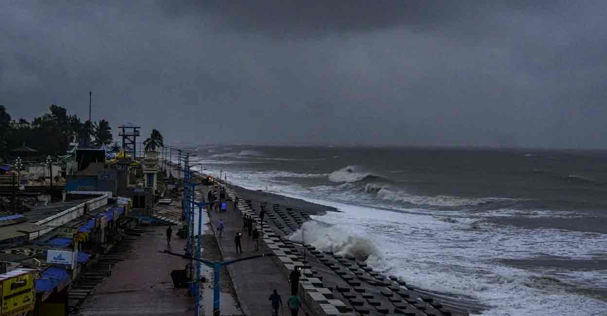
Cyclone Dana makes landfall on Odisha coast; Bhubaneswar, Kolkata airports resume operations

Mail This Article
Bhubaneswar: The severe cyclonic storm 'Dana' began making landfall on Odisha’s coast on Thursday night, according to the India Meteorological Department (IMD). The process is expected to last until Friday morning.
The coastal districts of Bhadrak, Kendrapara, Balasore, and Jagatsinghpur have already experienced heavy rainfall and wind speeds ranging from 100 to 110 kmph. The Special Relief Commissioner's office reported instances of uprooted trees, but no major damage or casualties have been recorded so far.
Moving north-northwest at 15 kmph over the last six hours, the storm made landfall between Bhitarkanika in Kendrapara and Dhamra in Bhadrak, with winds reaching 110 kmph, an IMD official said. “The forward section of the cyclone’s wall cloud has begun entering the coast. This process will continue until Friday morning," Umashankar Das, senior scientist at the Regional Meteorological Centre in Bhubaneswar, told PTI.

Wind speeds are expected to reach up to 120 kmph as the cyclone’s center hits land, with the landfall process predicted to last four to five hours. The IMD is closely monitoring the system using the Doppler weather radar at Paradip.
Odisha Chief Minister Mohan Charan Majhi stated that Prime Minister Narendra Modi and Union Home Minister Amit Shah have been briefed on the state's preparedness. Around 5.84 lakh people have been evacuated from high-risk areas in coastal districts ahead of the cyclone.

IMD Director General Mrutunjay Mohapatra warned that wind speeds could reach 120 kmph and that tidal surges in Kendrapara, Balasore, and Bhadrak could rise by up to two meters above normal levels. The cyclone is expected to weaken on Friday as it moves inland, bringing heavy rainfall across the region.
Gusts of 100-110 kmph are forecasted to persist along Odisha’s northern coast until Friday morning before gradually subsiding. Southern coastal regions may see wind speeds of 60-80 kmph. Heavy rain is expected in most areas, with extremely heavy rainfall likely in Balasore, Mayurbhanj, Bhadrak, Kendrapada, and nearby districts through October 25.
Bhubaneswar, Kolkata airports open
Biju Patnaik International Airport resumed its operation at 8 am this morning as the weather conditions became normal in Bhubaneswar, an official said.
The airport operation was suspended from 5 pm on October 24 in view of cyclone Dana which made landfall between Dhamra and Bhitarkanika from midnight to early morning.
Though the airport authority had decided to suspend flight operation till 9 am on Friday, the operation resumed at 8 am as the weather conditions became normal, said Airport Director Prasanna Pradhan.
Operations at Kolkata's Netaji Subhas Chandra Bose International Airport, which were suspended from 6 pm on Thursday, resumed at 8 am on Friday.
South Eastern Railway (SER), which oversees routes in West Bengal, Odisha, and Jharkhand, has cancelled more than 170 express and passenger trains scheduled between October 23 and 27.
Additionally, Eastern Railway cancelled 68 suburban trains in the Howrah division for Friday morning, while all EMU local trains from Sealdah station were suspended from Thursday evening till Friday morning. Kolkata Port authorities also halted ship movements until Friday evening as a precautionary measure.

