ESZ demarcation: Kerala govt publishes Forest Dept maps, provision to file complaints available

Mail This Article
Thiruvanathapuram: The Kerala government on Thursday published the maps prepared by the Forest and Wildlife Department to demonstrate the high population density of areas just around the extremities of wildlife sanctuaries and national parks in the state.
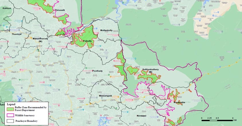
The maps, which include the buffer zones, or Ecologically Sensitive Zones (ESZ), around 22 wildlife sanctuaries and national parks, was published on the official website of the government.
Every village, block and plot-wise details are available on the map. The map chalks out the buffer zones around wildlife sanctuaries and national parks.
Now, the government has given time till January 7 for affected people to register their complaint if their properties or land have been included in the buffer zone proposed by the Forest Department. However, for the people to get a clear understanding, the survey numbers too will have to be published. Pinarayi said this would take a week.
With the satellite survey maps, the objective was to identify the man-made structures within the proposed ESZ around the 22 protected areas. The intention was to showcase the thick population density around most of the wildlife sanctuaries and national parks and convince the Supreme Court to exempt Kerala from the minimum one-kilometre ESZ norm wherever possible.
On the other hand, the Forest Department maps that have now been uploaded on the government website demarcates in green buffer zones within the proposed one-km ESZ.
In the case of the satellite survey, the anger was caused by non-inclusion of structures and agricultural lands. If there are not enough structures in a particular area, it was felt the Supreme Court could easily declare the patch as ESZ.
Take for instance the resolution passed by the CPM-led Sulthan Bathery Municipality against the satellite survey. Among other glaring omissions, it found that only 14 shops in a thriving town like Sulthan Bathery was included in the satellite image. Suddenly, there was fear that the town would be declared as ESZ.

As for the maps prepared by the Forest Department, the objections, if any, would come from inclusion within the buffer zones marked in green. Such an inclusion would mean that the government would want a particular property or built-up space within the ESZ.
Twelve categories including buildings, enterprises and roads are marked on the map. The ESZ areas are marked in pink. The other colour codes are as follows:
- Green- Forest
- Black- Panchayat
- Red- Commercial establishments
- Brown- Office
- Yellow- Places of worship
- Violet- Residential areas
A preliminary report which includes the list of buildings, enterprises and other constructions within one-km radius of the protected area has also been published.
Instead of the controversial satellite survey conducted by the Kerala State Remote Sensing and Environment Centre (KSREC), the LDF government has decided to submit this map prepared at least five years ago to the Supreme Court.
The decision was taken at the high-level meeting convened by the Chief Minister on Wednesday. "The Forest Department's map has excluded all human habitations, constructions and agricultural lands from the proposed ESZs," Chief Minister Pinarayi Vijayan told reporters on Wednesday. "We will submit this map before the Supreme Court and the Central Empowered Committee," he said.
This map, and not the KSREC's satellite images, would be the authentic document that Kerala would furnish.
Further, he said these maps would be displayed in all the wards that could potentially come under the proposed ESZs.
For collecting such information, helpdesks have been set up at all affected wards. Such information has to be given in prescribed proformas that are available at these helpdesks and could also be downloaded from the government website.
According to sources, the Forest Department had first prepared such a map during the UDF tenure, when the anti-Gadgil protests were in full swing.
The draft map that is now published had taken out all human habitations, structures and livelihood spaces from the ambit of ESZs. This map is already under the consideration of the Centre. According to the Chief Minister, the Centre was about to issue a draft notification on ESZs on the bass of this map when the Supreme Court delivered its June 3 order this year.
The Chief Minister said even this map would be revised if people could point out omissions.

