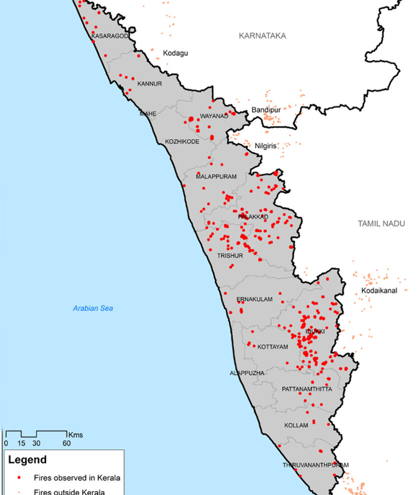
Thiruvananthapuram: Satellites have found evidence of 567 fires, both small and large, across Kerala over the past 55 days. The numbers were made available after assessment of images captured by NASA’s Lance Firms and European Union’s Copernicus Sentinel satellites from January 1.
The map was created for Manorama by Raj Bhagat, a senior project associate at World Resources Institute based in Washington.
Idukki leads with 190 instances of fire. A minor fire broke out on January 23 in forest next to Kakki reservoir in Pathanamthitta. But neither the local people nor fire department knew about this. Even when such small episodes don’t show up in official accounts, satellites catch them easily.
Raj analysed four satellite images every day to map them. Satellite with multi-spectral devices can detect fire by analysing changes in temperature on any surface in the world. Burnt down patches in forests are also detected.

A fire at Brahmapuram waste treatment plant in Kochi was contianed on Sunday, after three days. Air quality was affected in Kadavanthra, Vyttila, Maradu and Ambalamugal with several residents complaining of eye and throat irritations. Four incidents of fire were reported from the same plant in the last couple of months.
Outside state, Bandipur and Kanyakumari have seen large number of fires too. Images from Banasura Hills in Wayanad will be available in the next few days.
Districts and fires caught on satellite images: Idukki – 190, Palakkad – 118, Thrissur – 74, Wayanad – 67, Kottayam – 26, Malappuram – 23

Read more: Latest Kerala news


.JPG.transform/576x300/image.jpg)


